
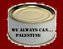
L'archipel de Palestine orientale
In better quality, legends and explanations... (meilleure qualité)
http://strangemaps.wordpress.com/
Carte imaginée et produite par Julien Bousac à partir de documents fournis par le Bureau de coordination pour les affaires humanitaires dans les territoire palestiniens occupés et B'Tselem.
Toutes les zones de Cisjordanie aux mains d'Israël ont été transformées en mer.
Ile de la Grande Palestine, Ile aux Oliviers, Ile du Nord, Ile aux Moutons, Ile d'Hbron ...
Avec ses canaux
Avec ses lignes maritimes aléatoires reliant les différentes îles
Avec ses codes touristiques et ses nombreuses plages en "zones sous surveillance"
Avec ses quelques taches de zones urbaines
Inutile de préciser la présence de requins, courants violents, bourrasques destructrices.A trouver dans "l’Atlas 2009 du Monde diplomatique" intitulé Un monde à l’envers (196 pages, 14 euros)
Note about the paper published just before... April's fool...
To imagine children, families, youngsters, young women dreaming of getting married, having a life, young men dreaming of a future, older people, elders who saw so much, some of them born in refugee camps, seing their sons, daughters, grandsons in conditions even worse...
To imagine all these people in the hands of such fools
Fools who benefits of the "social, information... rupture" how was it called ?
To imagine such fools representing the people who could use their useless brains
To imagine all these people in the hands of such fools representing a kind of idiotic opinion
To imagine so many States who could act for these people, all this in the hands of this silly opinion
it's such a level of craziness that I really wonder if some day, the world will arise and make the waters retire themselves from this place.


Aucun commentaire:
Enregistrer un commentaire